The Julian Bikepacking Challenge Bfl
April 2019
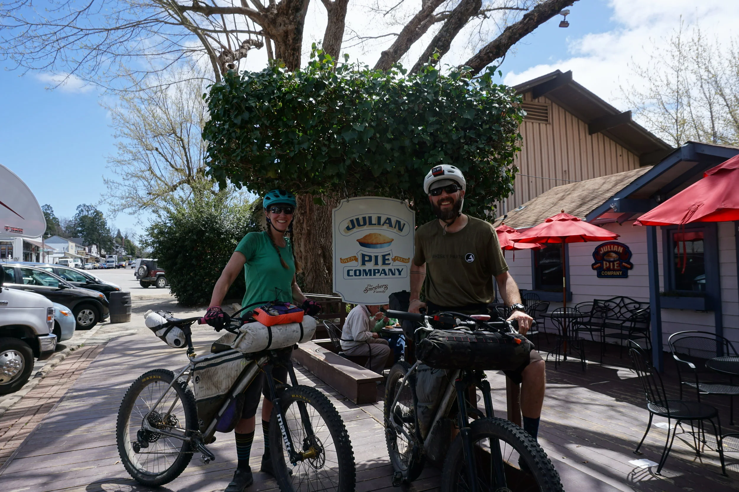


It was 4:30pm when we finally arrived at the Julian Pie Company. The line was out the door and they were closing promptly at 5pm. We needed to eat the pie. We knew we would roll out well before they opened in the morning, so we waited patiently and slowly crept to the front of the counter. “One piece of Dutch apple with ice cream for here. One piece to go. Oh and two cider donuts.” I wonder what the pie with the melted sharp cheddar cheese tastes like?...oh well, another time.
We grabbed the last table in the rear courtyard and devoured the delicious treat. We couldn’t start the BFL without the pie and we both felt complete!
We headed over to the Julian Beer Company and ate our beef brisket with beer cheese sandwich, downed a few pints and enjoyed the small town atmosphere. We grabbed a few last minute items from the mercantile and headed back to camp at William Heise County Park, just a few miles outside of town. It would be an early morning, but that didn’t stop us from trying to burn the eucalyptus wood and drink a beer. We tried in vain to keep our fire going while all the campers around us kept saying, “just put some more lighter fluid on it.”
6am came and we loaded up the truck and drove back into Julian. We found a spot to leave the vehicle, unloaded the bikes, strapped on the bags and headed to Granny’s Coffee Shop for a coffee, the most delicious mixed berry scone and a breakfast sandwich to rival all breakfast sandwiches. We met the town wanderer, talked bikes, obliged his stories and then pedaled out of town. As we climbed the sleepy road West out of Julian, the excitement of our new adventure set in. We quickly arrived at the Santa Ysabel Preserve and jumped on some dirt two-track. We snaked through the preserve and were ultimately dumped out on Hwy 79 for a brief stint until we met the next road connector. This was fairly typical of the route...ride dirt, intersect a highway, climb the highway, find next dirt.


From Julian to Escondido it was roughly 50 miles utilizing the “Coast to Crest” trail system, a cool singletrack option paralleling the road and ultimately the San Dieguito River Park leg to send us all the way to the Pacific. The trail crosses through and around some beautiful orange groves and a spectacular nursery of giant palm trees. We stopped at the Farmer’s Market just off the trail near Escondido (Sunday from 10-3:30!), enjoyed some righteous tamales, strawberries and oranges, refilled our water and were off to try and reach the ocean by sunset.

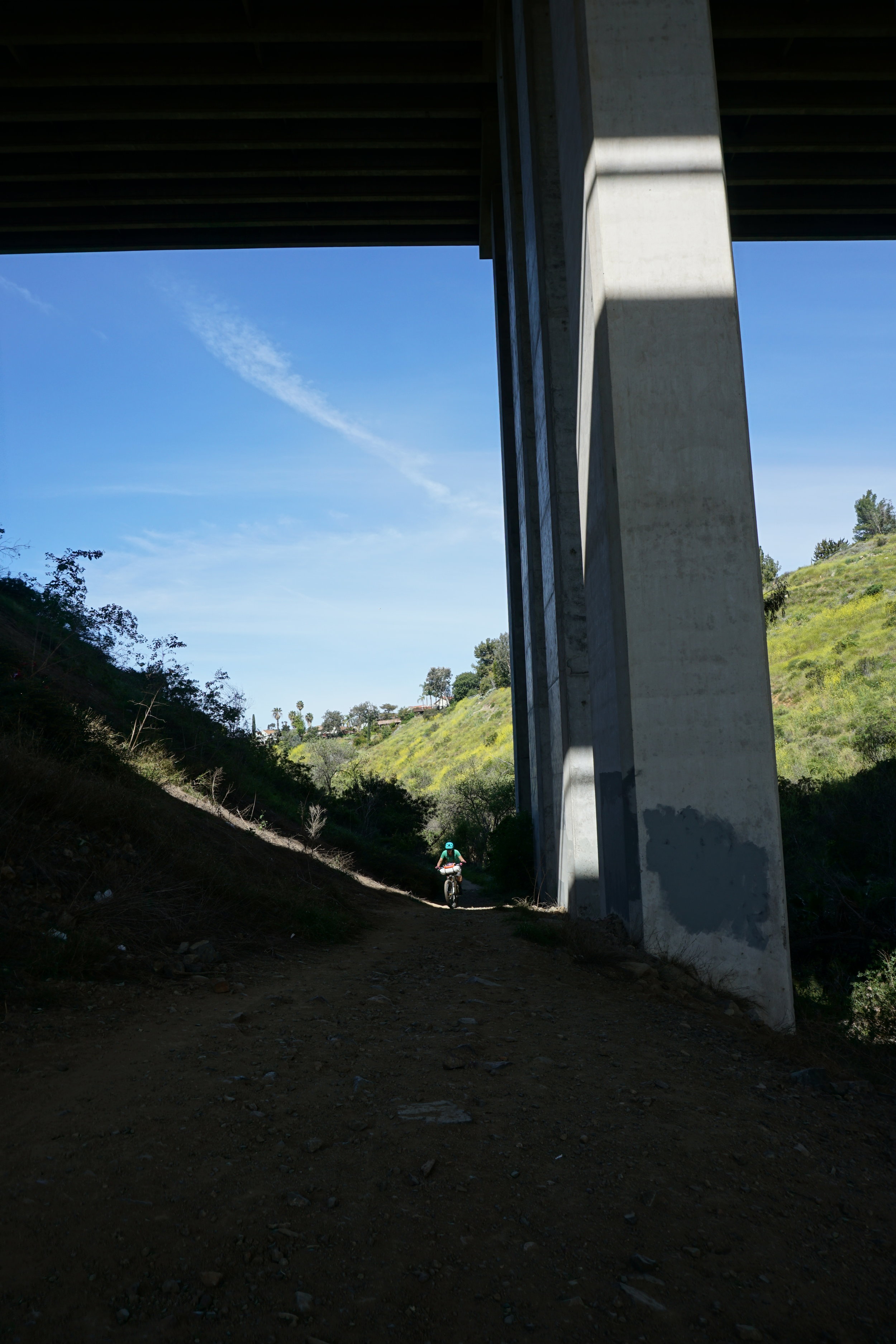
The next leg of urban singletrack through the neighborhoods was particularly satisfying! We rolled up and down the hills following the power lines, with hot air balloons literally floating over our heads. We came across our first and only rattlesnake, which we gingerly circled around, and finally heard the crashing waves of the ocean.


One last stop at the 7-11 to fuel us to dinner and then we arrived at the Brigantine Grille at 9pm for dinner. 88 miles down and we were starving.
Luckily the kitchen was open until 10 and we couldn’t have had a better experience. Our server was Chadd from Carlsbad, a motocross racer turned enduro MTB racer, who was the absolute perfect person to talk to after our long day. We enjoyed some amazing food and beer and then headed off to find our resting place for the night.


Camping was our biggest concern this first night, and our research told us that 3 miles to the north was San Elijo State Beach. Everything we read and heard about this place was that it was hiker/biker friendly and we would have no trouble finding a spot. Unfortunately that was not the case, as the campground was completely booked and the ranger was not about to let us in for the night. We gave him our sob story, which didn’t work, he told us camping on the beach was illegal, and then followed us out of the campground to ensure we didn’t sneak back in. Exhausted and frustrated, we went to Plan B - the Holiday Inn. While we weren’t planning on a hotel stay, it was our only choice. It was midnight, we certainly didn’t need to get arrested on the beach, and we literally had nowhere else to go - at least it came with free breakfast - and those biscuits and gravy and Cinnabon cinnamon rolls were DELICIOUS.
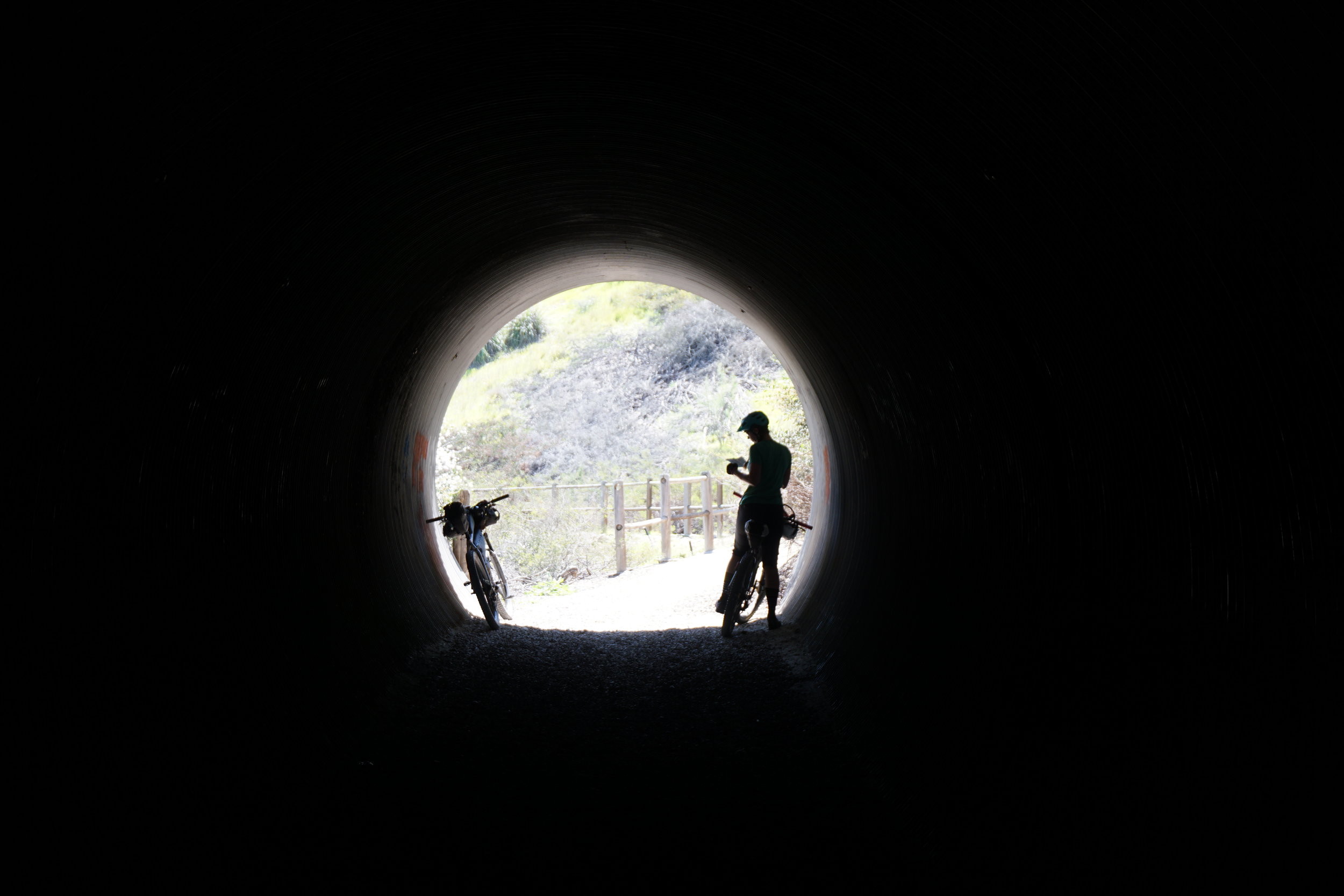
We rolled out early to get a jump on the day. We were shooting for another 70-80 miles and knew that getting into the mountain section was going to be tough. We rode along the beach that morning, taking in the view we missed the night before. Less than 10 miles in, we came across Roberto’s Tacos and it is NEVER too early for a taco! Second breakfast came earlier than expected! With full taco belly’s we jumped back on the trail and wove through the Los Peñasquitos Canyon Preserve, more dirt! The following hours were some of the hardest miles of the loop. Lots of road climbing, backtracking through the orange groves from the day before, busy highways and mentally exhausting. We stopped in Poway for a refreshing slurpee (Garmin was reading 108 degrees!) and then slogged our way to Ramona where we hit rush hour and cars flying by us as we tried to dodge the drains set awkwardly sloped in the bike lane. We miraculously survived this stretch and found the next glowing beacon - the Taco Shop. 7 tacos later, we hit the road as the sun began to set and hit the national forest.
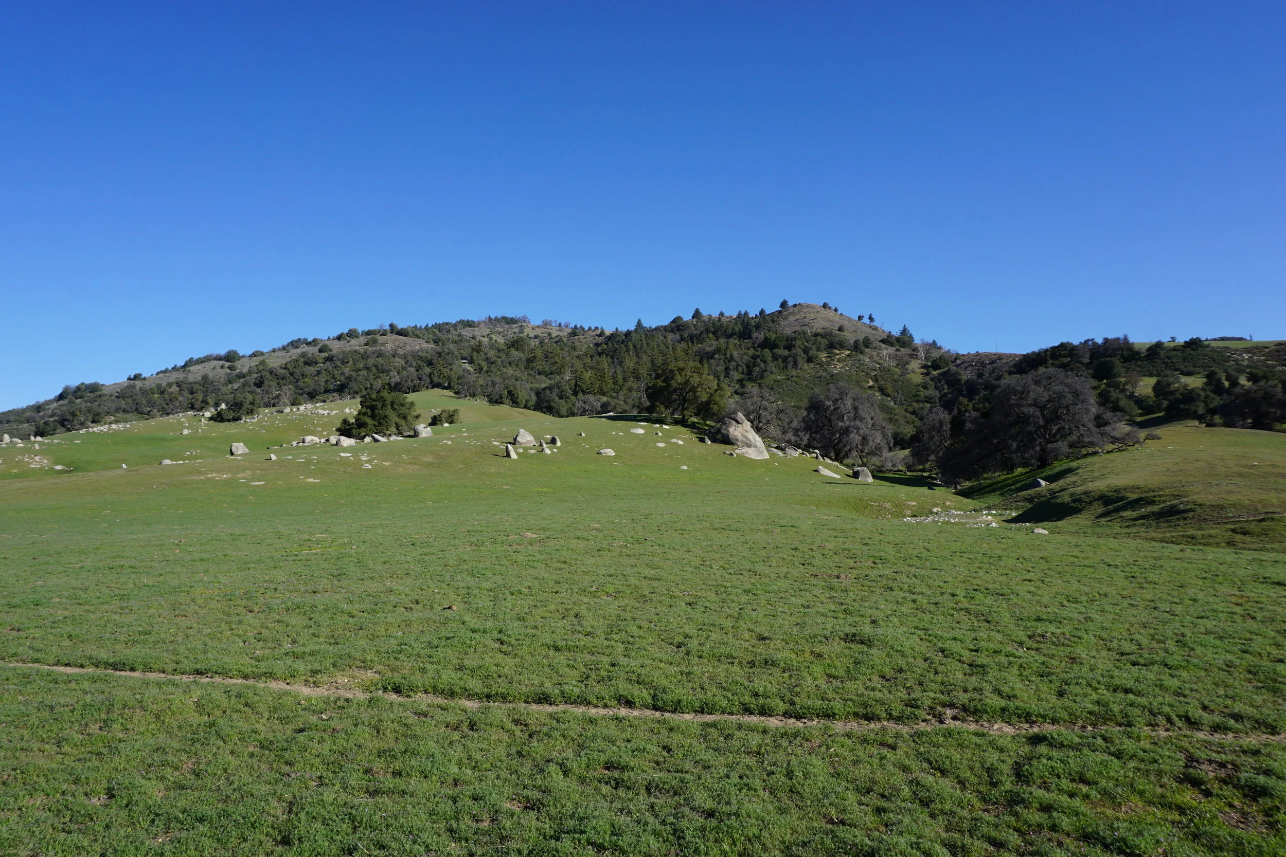
We found night two’s camp spot and tried in vain to get some sleep. We woke early to meet our next big climb, which was much better than the cue sheet led us to believe. Halfway up, we stopped to make coffee and eat some breakfast, all while taking in the views over the valley. A short while later, we had reached the top, hopped the vehicle barrier to a rocky descent on a dirt truck road, and then hit the intersection for Engineer’s Road - a long, steady asphalt road climb up towards Lake Cuyamaca. This climb was also better than the cue sheet led us to believe - not nearly as busy and with grades that were easier to swallow. We crested the top of the hill and were met with a windy downhill to Lake Cuyamaca Store & Restaurant just in time for lunch. We settled in to a table by the window and enjoyed a burger, BLT and a hefty slice of apple pie. A quick purchase of sunscreen and we were back on the road (Side note: Kristen purchased sunscreen in Julian and it smelled exactly like Catnip.)
A short time on the highway and we found the next trailhead.


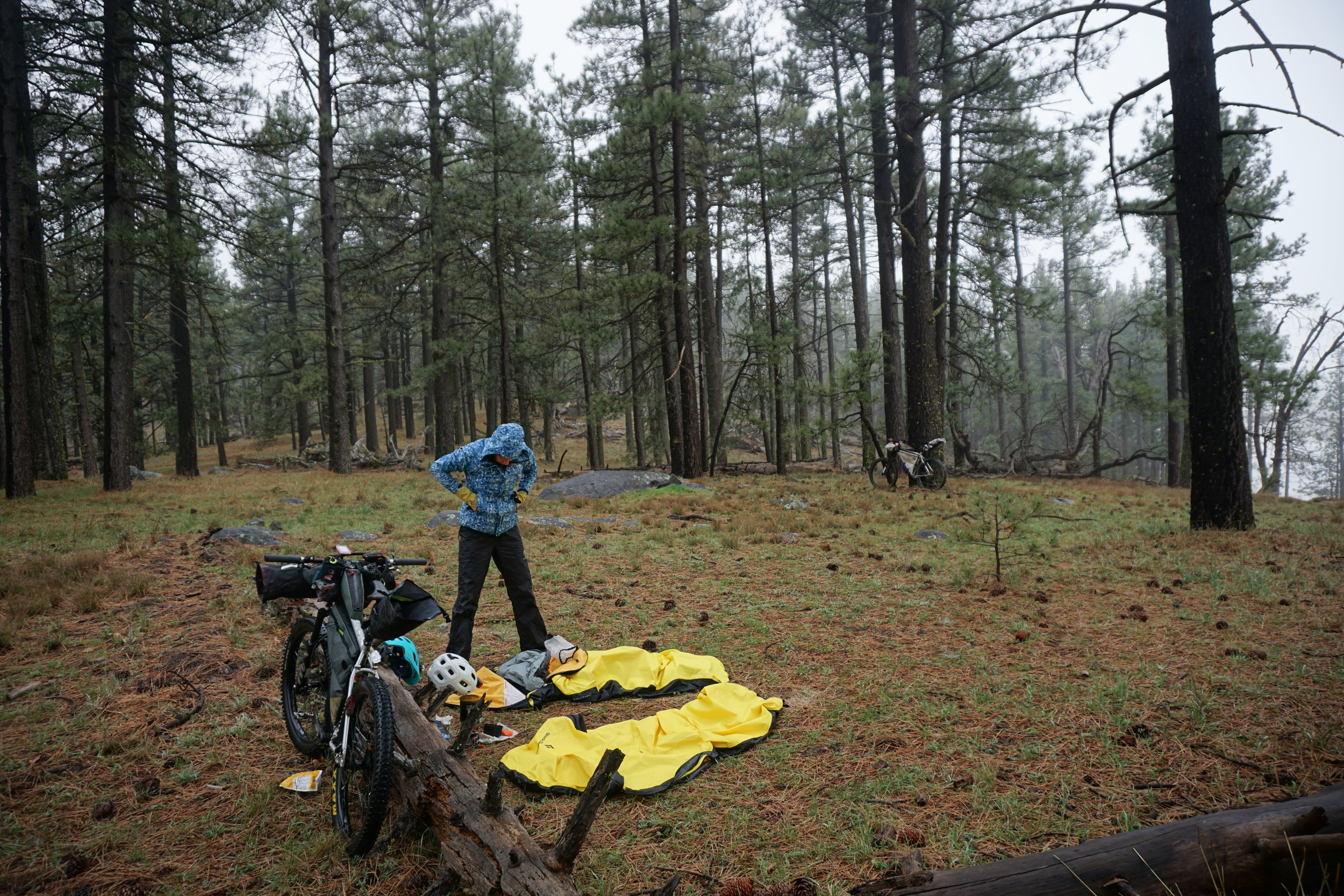
The rains from the previous week left the beginning of the trail submerged in water, so took off our shoes and carried our bikes through the water. Luckily the rest of the trial was in good shape, so we continued to ride the singletrack until we hit the next truck road. The hours began to disappear as we climbed and climbed. The temperature started to drop and we watched the dark clouds blow across the sky. We were both tired, losing steam and lacking water. We pulled out the cue sheet and determined we weren’t going to make our mileage. We looked at the route map and saw an opportunity for camp with a water source, so we pushed on and arrived just as the sun had set and darkness set in. It was cold and windy that night. We hopped in our bivys and struggled to make our Good to Go Meal while trying to keep warm and dry. The rain poured all night and the wind whipped our tents around until morning. We both peeked out of the bivy, only to see a thick fog hanging in the air, followed by rain. Another 30 minutes and then we’ll get out, we agreed. Finally the weather stopped, we packed up camp and made coffee. A short pedal and we should be at the Mt Laguna store - another big milestone for us and resupply point. When we arrived, there were two PCT hikers on the porch enjoying the morning sun that had finally broken through the clouds. We chatted with them for a few minutes and then wandered aimlessly through the store in search of second breakfast. We enjoyed our treats on the porch and watched more PCT hikers arriving to get their resupply boxes.


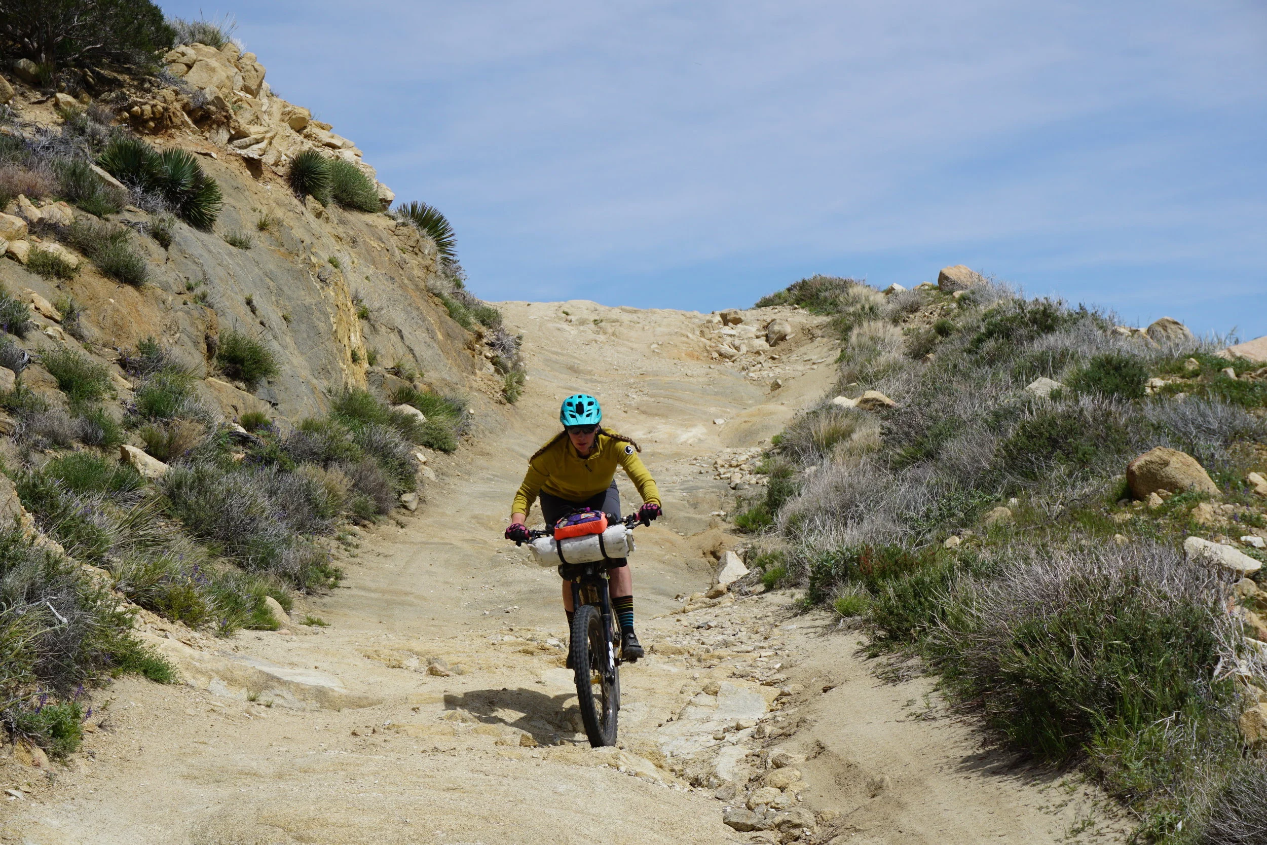
Back on the trail with big miles on the horizon and excitement to make our way into the desert. Leaving the tall trees for the barren landscape of sand and cacti was a welcome transition as it meant we had one more big loop off the big loop to go! Another short highway stretch, rocky truck trail, random trailhead offshoot and we were sailing through singletrack. We enjoyed some lunch in the shadow of the one rock on the hillside and made our game plan. No matter what, we were going to get to Borrego Springs and get the miles we lost from the day before.


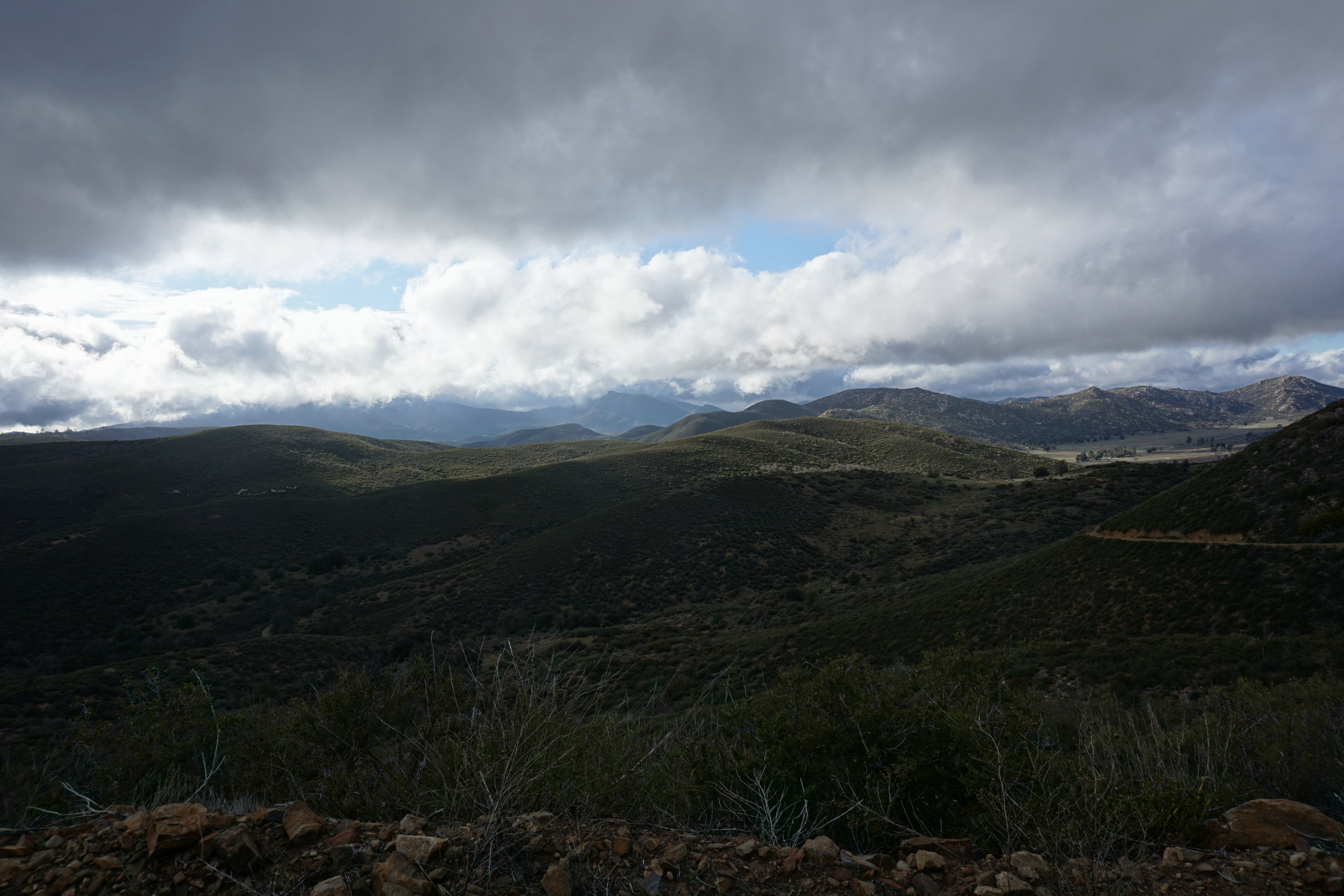
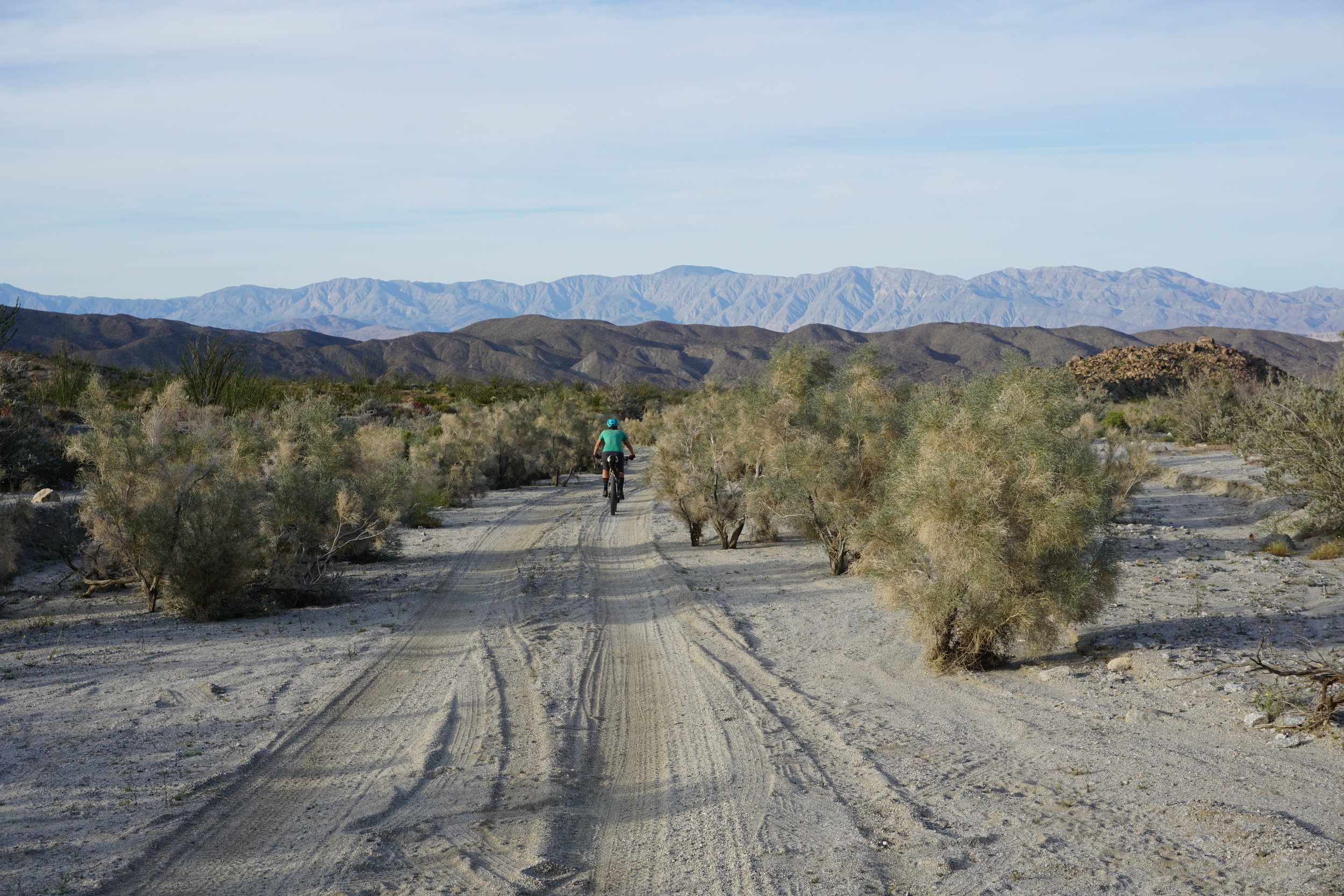
Fortunately, the desert was kind to us and our plus tires in the sand made short work of the arroyos. The temps stayed bearable and we slathered on sunsceen until the Stagecoach RV Trails Resort appeared like a mirage in the distance. A giant turkey sandwich, a Pepsi and an ice cream sandwich put our heads back on and we felt good. We were killing it! We left the road for more sandy dirt, slim canyons and the hardened mud of the wash. The sun began to set as we clicked off the miles, but we couldn’t stop ourselves from hopping off the bikes to take photos of the blooming cactus. We must’ve been in the middle of a butterfly migration as well, as there were millions of butterflies crossing our path as we flew down the dirt road towards the highway. We made it to Borrego Springs just as the last light of day hit and had our site set on climbing Yaqui Pass Road and setting up camp on the other side. We climbed the endless asphalt of the pass in the dark with the road completely to ourselves. It was late and we knew we couldn’t get to the other side, so as we finally crested the top, we found a primitive campground where we could stay for the night. After a few hours of restless sleep, we woke early with the excitement that we would be finishing!


It was Thursday morning - our original goal was to finish Wednesday night. With the big push from the day before, we knew we would at least be back in Julian in time for lunch and a well-deserved beer. We bombed down the other side of the pass and traced our tracks back to the Stagecoach RV Resort and were just a bit too early for them to be open. We kept rolling back down the highway, through the sand, and onto the Rodriguez Spur Truck trail - the longest dirt road EVER.
The trail was in rough shape from the rains the weeks before, so a lot of hike-a-bike ensued. The road finally ended and was a true intersection of the PCT. We said hello to one hiker who was practically running toward the trail magic hidden on the hillside and made our way to the Banner Recreation Ranch, which is more like a glorified mobile home park. The cue sheet talked of a water vending machine that we were excited about, but didn’t quite pan out. It was in pretty sad shape and we didn’t have change!! Oh well, it probably would’ve made us sick anyway! One last brutal climb up the road and onto another old truck trail. We climbed the three miles up to the road intersection, encountering the strangest abandoned RVs and old mine camps (or meth labs!) and were elated as we made the final turn on Highway 78 back to Julian. It was noon and we were finished - finishers three and four of the Julian Big F* Loop! We bought more pie, drank a beer, found our truck in the spot where we left it, loaded up and hit the road for San Diego.